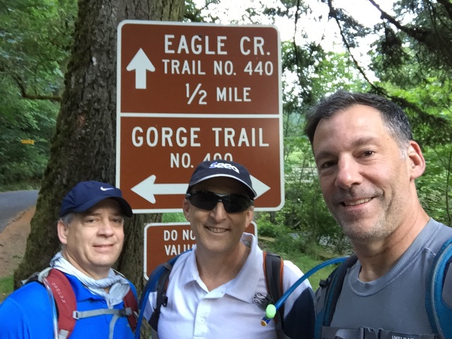
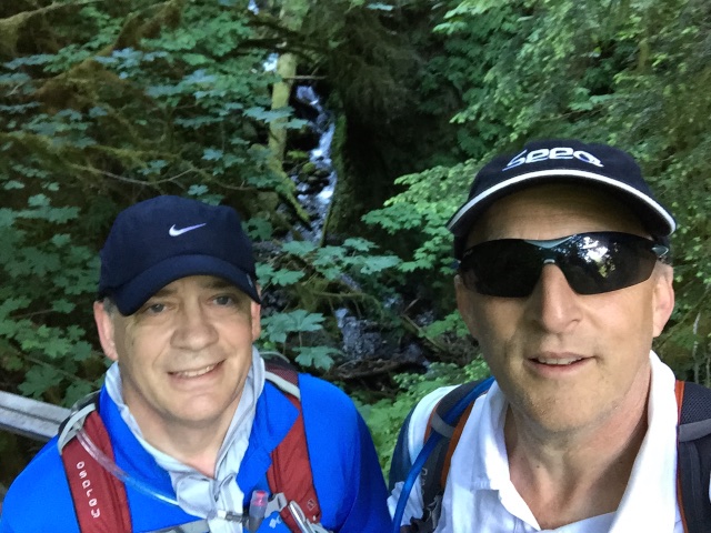
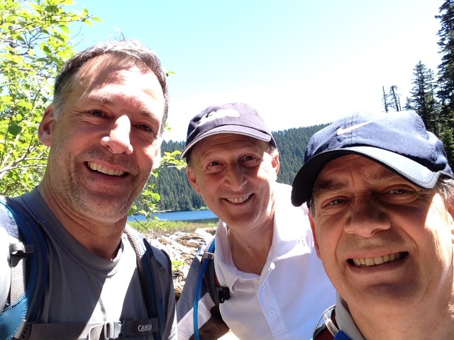
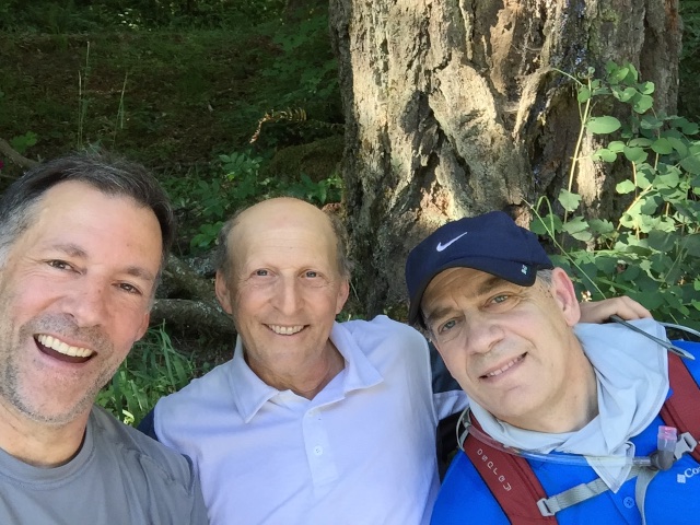
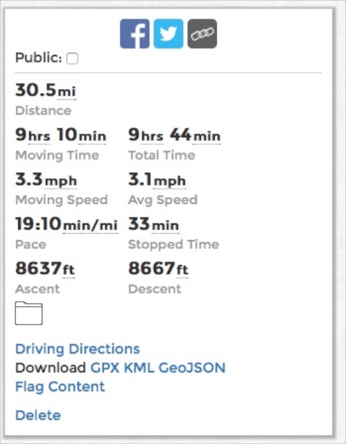
I completed a hike from the Eagle Creek Trailhead along Trail #440 up to Wahtum Lake and return. The trail is listed as 27.5 miles but our hiking programs estimated our actual hiking distance as 30.5 miles. Brian Parsonnet and Michael Risse, my colleagues at Seeq, joined me in this quest.
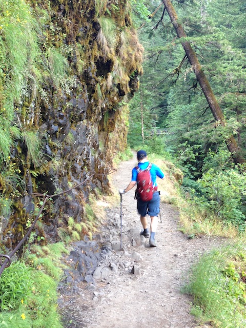
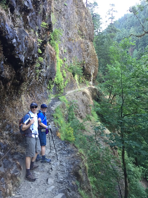
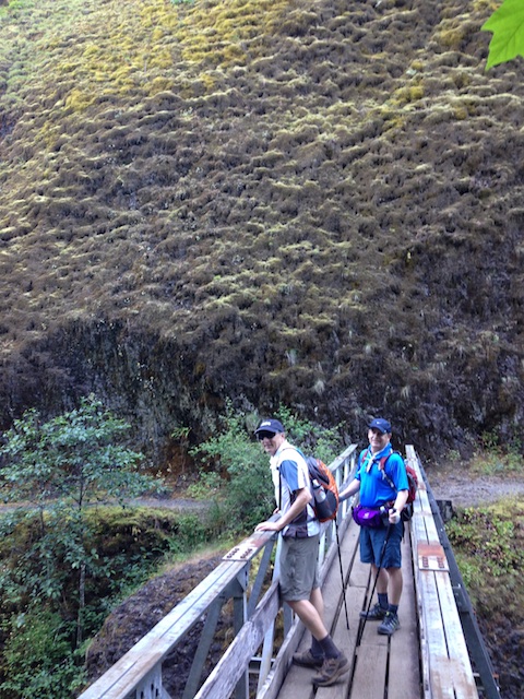
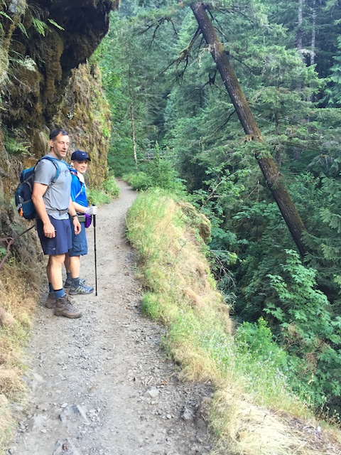
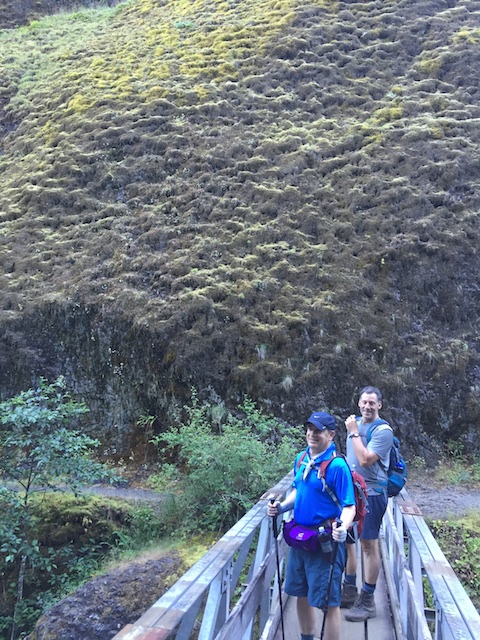
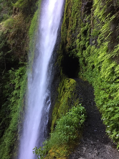
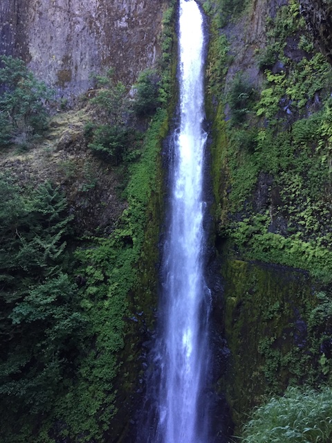
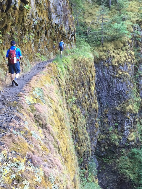
The Eagle Creek Trail is one of Oregon’s most spectacular paths, passing half a dozen major waterfalls. The trail is also an engineering marvel. To maintain an easy grade through this rugged canyon, the builders blasted ledges out of sheer cliffs, bridged a colossal gorge and even chipped a tunnel through solid rock behind 120-foot Tunnel Falls.
Online trail hike descriptions:
This was on my Sixty Sixties list. I’d say it was one of my more difficult Sixty Sixties items as the specific goal was to take 60 minutes off the time when I had executed this hike over 10 years ago (younger). That time I did it with Matt Mazur and although we were completely unprepared for the required hike logistics, we somehow managed to finish the hike. We arrived back at the trailhead after dark, causing Nancy much concern. I estimated the roundtrip time at 14:10 for that hike.
Brian and I trained for this hike. Brian did Horsetooth Trail (link) near Ft. Collins at 7,000 ASL which as 5 miles round trip with 1500′ elevation change. He got to where he did this 3 times in one hike more than once. I trained a couple of times at Dog Mountain (link) near White Salmon which is 7 miles roundtrip with 3000 foot elevation change (but nearer sea-level). Michael trained on a treadmill, but he had done a hefty cross-country skiing race earlier in the year.
We planned months ago to do this on Friday June 12. Fortunately, the weather was nearly perfect. We got on the trail about 6:35AM with 55 degrees Farenheit and the temperature got up to about 75 degrees as the day progressed. We did get some hot spots through the trees near the end of the day but their was a gentle breeze as well.
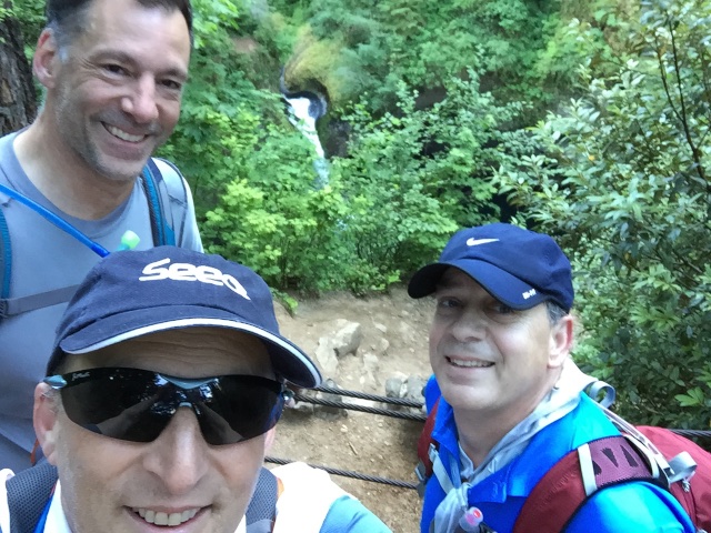
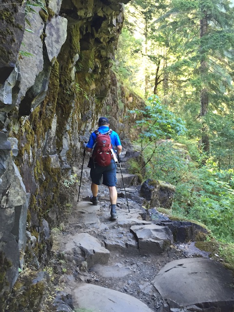
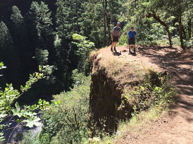
We started at a smart pace going up the hills. It has some interesting paths along cliffs. None of us are particularly fond of edges, but they did provide hand-rails when it was particularly steep. We stopped to get some photos at various spots, but unfortunately no photos can capture the beauty, grandeur, and scale of the trail, terrain, and particularly of the waterfalls.
We got to Wahtum Lake within 5 hours; took 30 minutes for lunch; and, then powered back to the trailhead starting point 5 hours later. I was huffing and puffing going up at our pace and coming down was easier, however, the rocky terrain kept us from increasing our pace. I got stung by a bee going up and Michael did coming down. We all tripped several times in the tricky terrain, but I was the only one to do a face plant. Fortunately that happened in the soft forest terrain and not along a cliff edge. I managed to bend one of my trekking poles though.
It was an awesome experience. We got home by 6PM and completed the day with Pizza and Beer.
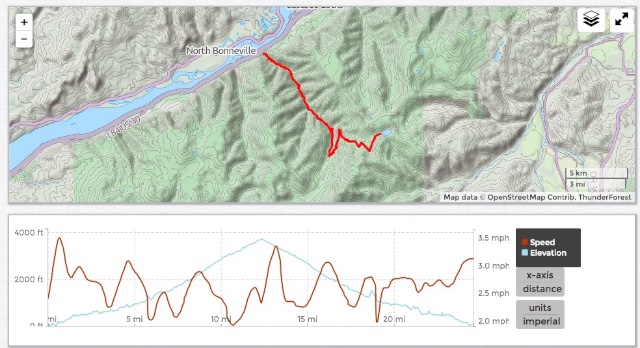
Here is a link to the hike record: hike record (slide cursor along the graphs to see corresponding position)
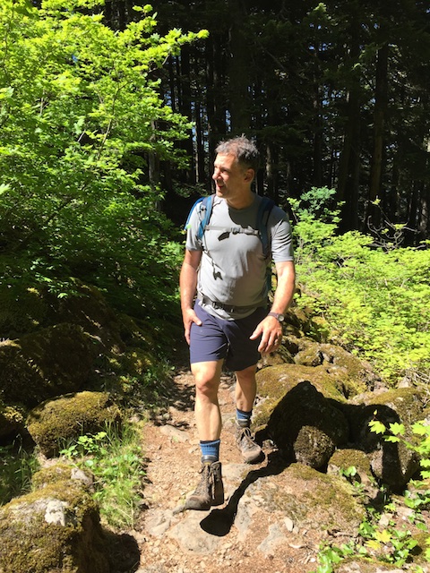
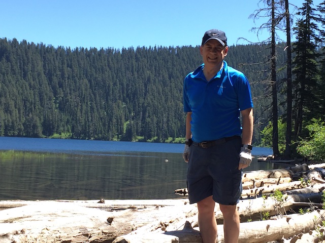
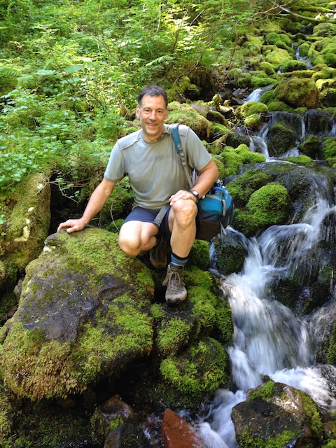
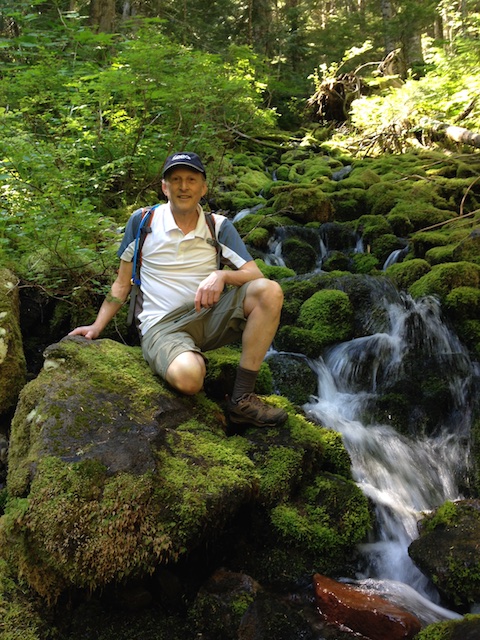
Here are some photos:
Here are some links to video files:
- Approaching Tunnel Falls (link)
- Passing through tunnel falls (link)
- Tunnel Falls Perspective (link)
- Hiking Snippet (link)
- Pace Example (link)
- Bird Song (link)

Share this Post